
1. Midtown Manhattan, New York
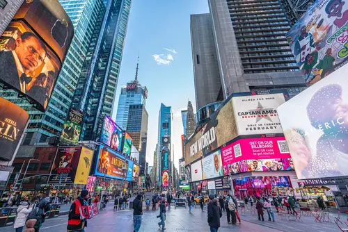
Believe it or not, Midtown feels walkable because of dense sidewalk life and transit access. Walking across 34th Street or approaching the Lincoln Tunnel, you’re hemmed in by streams of cars and idling traffic, especially during rush hour. Sidewalks can feel cramped or blocked by delivery trucks, making pedestrian progress slow and stressful. Despite being “walkable” on paper, the sheer volume of vehicles turns the neighborhood into a grind for pedestrians.
Passengers waiting at crosswalks complain the signal cycles feel too short or too long depending on traffic flow. The local DOT’s busway plan on 34th Street has residents worried it will redirect snarls onto narrower sidestreets. Even with ongoing pedestrian improvements, Midtown streets often resemble moving parking lots. The contrast between pedestrian vibrancy and vehicular chaos makes it a classic case of “walkable but only if you can tolerate the traffic.”
2. Queens Boulevard corridor, New York
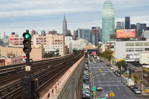
Queens Boulevard is technically walkable in the sense of shops, transit and density. But it’s infamous for being called the “Boulevard of Death” due to high pedestrian injury rates historically. Its wide multiple lanes encourage high speeds even in dense settings. Crossing on foot often means waiting through long light cycles while cars zoom by.
Pedestrians note crossings up to 300 ft long—one‑and‑a‑half city blocks—making it exhausting to cross. Despite safety retrofits, vehicle traffic remains intense and crossings perilous. It’s a prime example of a walkable neighborhood undermined by poor street design. The pedestrian environment suffers under the shadow of aggressive traffic flow and outdated road layout.
3. Bay Village, Boston
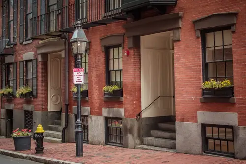
Bay Village is a charming historic pocket in central Boston, full of narrow brick‑paved streets and gaslit sidewalks. Still, it sits right along the Massachusetts Turnpike boundary, and marginal roads parallel the Pike can channel deafening car traffic. That traffic noise seeps into this pedestrian enclave and can turn walks into parades of horns and engines. Residents often remark that though the interior is quaint, every crossing toward Tremont or Chinatown can feel stressful.
Despite the tiny one‑way grid reducing through traffic inside, the surrounding arteries feed constant streams of vehicles. Pedestrians say it almost feels like islands within a riptide of car traffic. For every peaceful stroll inside, there’s a terrifying edge crossing nearby avenues. In short, lovely to live in—disconcerting to walk out of.
4. South Beach, Miami Beach
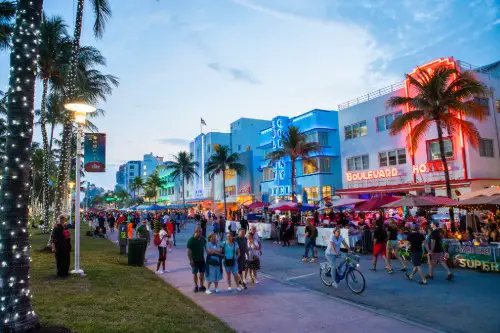
South Beach is ultra‑walkable for tourists, with pedestrian‑only Lincoln Road and dense retail strips. Yet car congestion around Ocean Drive, Washington Avenue and Collins Avenue is so constant that driving in becomes a nightmare. Bus and trolley lanes often run slowly because cars double‑park or clog intersections. The sensory overload of sirens, horns and idling taxis wears on pedestrians navigating the blocks.
Tourists often prefer walking or biking simply to avoid the slow crawl of traffic in this compact area. Even bike lanes can feel marginal alongside curbside congestion and high volumes. Despite retail‑rich streets and walkable layout, traffic noise and vehicle dominance can kill the vibe. It’s an ironic mix: walkable yet oppressive.
5. Old Fourth Ward, Atlanta
Atlanta’s O4W feels walkable with its BeltLine Eastside Trail and hip central amenities like Ponce City Market. But main roads like Freedom Parkway and Edgewood Avenue carry heavy vehicle loads, especially during commuter hours. Pedestrians using crosswalks or the BeltLine often wait for long gaps or navigate snarled turning traffic. Vehicles dominate crossings and bike paths interface awkwardly where traffic speeds pick up.
Despite public transit access by MARTA buses and the streetcar nearby, many residents still drive short trips, feeding congestion. The dramatic transformation has improved walkability in places—but the traffic on key arterials undermines the pedestrian experience. In essence, it’s walkable in theory, frustrating in practice.
6. Society Hill, Philadelphia
Society Hill is beloved for historic charm, leafy greenways, and proximity to Old City. But Walnut‑Spruce corridor and 8th Street bring heavy traffic from Market‑Frankford subway access and major bus lines. Tourists and commuters flood the sidewalks, while cars zip along boundary streets with little pedestrian pause. Crosswalk times sometimes prove too short for slower pedestrians navigating the greenways.
Even though internal streets are calm, stepping onto the main roads can feel like entering a traffic funnel. Sidewalk congestion, bus stops, and turning vehicles all collide. The neighborhood feels friendly until a crossing forces you to negotiate car‑dominated perimeter roads. It’s a walkable gem bordered by tense traffic edges.
7. Downtown Boston (e.g. Back Bay)
Back Bay and Downtown are dense and transit‑rich, making many errands doable on foot. Still, major arteries like Stuart, Arlington and Columbus Avenue funnel rush‑hour traffic through the heart of the walking zone. Pedestrians on the sidewalks can find themselves dodging turning vehicles and distracted deliveries. Some intersections are awkwardly timed, making crossing a stop‑start ordeal.
Even with Crosswalk improvements and traffic calming in pockets, the main chokes remain. For locals, the convenience of walkable retail comes with tense crossings and vehicle noise. The walking experience fluctuates depending on whether you’re off the main roads or wedged between them. It’s walkable—but better suited to bravely alert pedestrians.
8. Upper West Side, Manhattan
Upper West Side feels pristine for walkability, with walk scores near 100 and endless shops, parks and subway lines. But Broadway, Amsterdam and Columbus Avenues see relentless double‑parking, delivery trucks, and traffic backups. Pedestrians may wait through multiple light cycles just to cross Broadway during peak hours. Roadside congestion bleeds onto sidewalks and crosswalks.
Truck ads, emergency vehicles, and ride‑share pickups add to the road chaos. Even side street serenity is tempered by the thrum of parallel avenues. It’s walkable in scale and amenities, but jarring in urban rhythm. Residents often say they walk to avoid driving—but still must dodge car‑world interference at every turn.
9. Decatur/Edgewood in Atlanta (Buford Highway corridor)
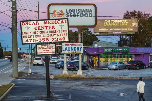
The Buford Highway corridor area is culturally vibrant and transit‑served by MARTA and Gwinnett buses. WalkScore metrics pick up density and retail access—but pedestrian infrastructure is severely lacking. There are huge multi‑lane roads with minimal sidewalk coverage, no medians, and rampant car traffic. Dozens of pedestrian injuries and several deaths led to the area’s infamy as one of Georgia’s most dangerous corridors.
Locals recount fear crossing between strip malls on foot, even though everything feels close in theory. Crossing gaps and speeds are mismatched with walking pace. The mismatch of high pedestrian demand and minimal safety design makes it feel like a gauntlet. This contrast embodies our theme: walkable‑looking, but perilous in reality.
10. DuPont Circle area, Washington D.C.
DuPont Circle is known as pedestrian‑friendly: cafés, bookstores and transit all within walking distance. The circle itself, though, is surrounded by multi‑lane streets feeding fast commuter flows. Crosswalks can feel harsh, with narrow timing windows and abrupt turning traffic at the roundabout. Tourists and bike riders often collide with impatient drivers weaving around.
The charm of walkable squares is peeled back when trying to cross Connecticut Avenue or Mass Ave. There’s a tension between pedestrian density and vehicular throughput. Sidewalk life thrives—but intersections feel adversarial. Nice on paper, exhausting in the streets.
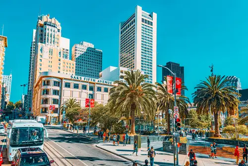
11. Fisherman’s Wharf/Pier area, San Francisco
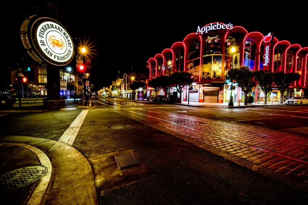
Fisherman’s Wharf is dense with shops and transit stops, billed as walkable for tourism. However, streets like Jefferson and Hyde are choked with tour‑shuttle buses, cars fighting for parking, and constant loading activity. Pedestrian flow slows to a crawl as crosswalks are blocked or delayed. The constant shuffle of vehicles interrupts what might otherwise be a pleasant stroll.
The backlash from pedestrian groups points to narrow sidewalks and erratic signals. Even cable car traffic adds to the confusion at major intersections. Walking here involves weaving through traffic jams—not unfolding a leisurely urban promenade. Unquestionably a visitor magnet—but not always easy to walk.
12. The Loop neighborhood, Chicago
Chicago’s Loop is extremely walkable in theory: dense office towers, transit hubs, retail. But six‑lane streets like Wacker, Dearborn and State see nonstop traffic, especially for buses, taxis, and delivery vehicles. Pedestrians cite delays waiting at lights as sightlines are blocked by large vehicles. Sidewalks feel busy but crossings feel prolonged.
Despite pedestrian plazas and walkways, roads remain car‑centric corridors. Locals report stop‑and‑go chaos during rush‑hour. The pedestrian experience is split: smooth among plazas, stressful at street edges. The contradiction is striking.
13. Waikiki, Honolulu
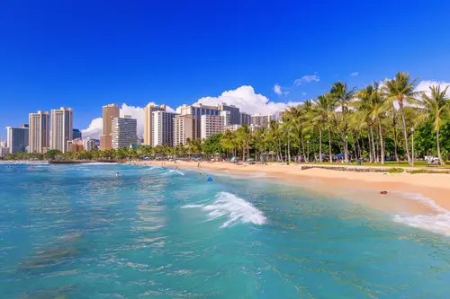
Waikiki is dense and compact, so many call it walkable, with shops, beaches, and transit nearby. Still, Kalakaua Avenue and Kuhio Street are clogged with tourist vehicles, buses, taxis, and trolley traffic. Pedestrians often wait through multiple signal cycles. The constant car shuffle competes with foot traffic on packed sidewalks.
People say they walk to avoid parking hassles—but still face constant car noise and crossing stress. The pedestrian strip stays jammed with slow‑moving traffic around every block. Lovely for beaches, but intensely urban in movement. A walking zone that feels stuck in a car bubble.
14. Union Square area, San Francisco
Union Square is great on foot if you’re just hopping between stores, transit stations and cafés. But Powell, Market, and Geary streets are usually overloaded with cars, ride‑shares, delivery vehicles, and cable cars. Pedestrians dodging around cars and stops can feel trapped in gridlock even amid high WalkScore. Sidewalk spillover and curbside chaos often degrade the walking experience.
Even well‑timed lights don’t help when crosswalks are blocked. Cars blocking bulb‑outs, double‑parking, or idle delivery vehicles make lines feel endless. The pedestrian experience teeters between vibrant and vehicularly oppressive. A walkable neighborhood that still runs at the mercy of traffic volume.
15. Inner Harbor area, Baltimore
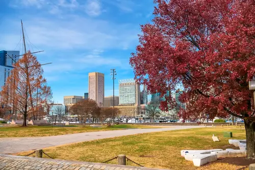
Baltimore’s Inner Harbor is framed by walkable attractions: shops, museums, waterfront paths. Yet surrounding arterial roads like Light Street, Pratt Street and Key Highway carry constant commuter and truck traffic. Pedestrians talking between blocks comment on noise, air and the need to avoid turning vehicles. Crosswalks often feel unsafe, even with timed signals and stop bars.
Despite the pedestrian promenade, the road network underneath is busy. One moment you’re strolling by the aquarium, next you’re having to avoid turning trucks crossing the pedestrian path. The total experience feels split between scenic and stressful. A walkable zone that still operates under a traffic shadow.
This post 15 “Walkable” Neighborhoods That Are Actually Traffic Nightmares was first published on Greenhouse Black.